 |
| License Plate images from the Monadnock-Sunapee Greenway Trail Club website |
The Monadnock Region offers numerous hiking opportunities, and depending on how rigorous a hike you want and how much time you have, there’s likely something to meet your needs. This blog is not intended to be an all-inclusive listing of the hiking opportunities in the Monadnock Region, but you'll find plenty of hikes from which to choose.
Hiking in Swanzey
There are many trails right here in Swanzey, just
moments from the inn, many of which are great for biking as well as hiking. Visit the Town’s website for Hiking
Trail information, where you’ll find maps of trails for
exciting hikes! The trails are rated from easy to more difficult. And some
trail heads, such as Mt. Cresson, Tippin Rock, Carroll’s Hill, and Dickinson
have paper maps. Enjoy one of the trails on Mount Caesar, some of which have
magnificent views of Mount Monadnock.
 |
| View from Mt. Caesar, from the Town of Swanzey’s website |
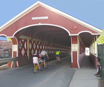
Bikers enjoy the Bike
the Bridges ride in Swanzey. Ride through the four covered bridges in Swanzey, catching the beauty of the countryside.
 |
| The Thompson Covered Bridge is a stone's throw from the Inn |
Pitcher Mountain
Pitcher
Mountain in
Stoddard, NH is one of our favorite hikes. It has a number of trails and the
views toward the White Mountains to the east/north and of Vermont to the west
are spectacular on a clear day! In late July and early August there’s an
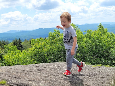
abundance of wild blueberries, so be sure to bring a container to gather them. There are often cows (with cowbells) in the fields adjacent to the trail -- a New England treat! We used to go up there with little ones, who were able to make the hike to the
top and now, again, we go there with young grandchildren.
 |
| 3-year-old Elliot, thrilled to reach the top of Pitcher Mountain |
Mount Monadnock
 |
| Mount Monadnock |
The grand hike of all is to the top of Mount Monadnock. It takes about four hours round trip, and it’s best to be prepared with drinking water, proper footwear, and a few snacks. Depending on the day or season, the weather can be different at the top, so dress accordingly. The view from the top on a clear day is magnificent. There are several trails, varying in difficulty, with some being strenuous. Detailed information about the trails can be found on the Back Road Ramblers website.
 |
| Reaching the top of Mount Monadnock (photo from the Monadnock State Park website) |
For those preferring a less rigorous hike, there are many trails around the base of the mountain. For more information, visit the Monadnock State Park website.
Note that reservations are highly
recommended to guarantee a parking spot as Monadnock sells out on weekend days
April-November. Visitors without reservations will be turned away when the park
is full. Click
here to make parking reservations.
There are miles of rail trails and
other trails throughout the region, some of which are great for biking. The
links below provide information about these trails, where to park, conditions,
maps, and planned activities.
The Cheshire
Rail Trail runs about 33 miles from Fitzwilliam to North Walpole. Explore
Keene has additional information on this trail.
The Ashuelot
Rail Trail runs 21.5 miles from downtown Keene to Rt. 63 in Hinsdale, with
easy access a couple of blocks from the Bridges Inn.
Pathways
for Keene offers four intersecting trails all connecting in the center of
Keene. Most are level and easy for any level hiker.
 |
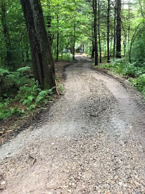
| Jonathan Daniels Trail from Pathways for Keene Website |
Goose Pond in
Keene offers a 2-mile
child and dog friendly trail around the pond, which also
features a forest clearing and concrete dock which are ideal for picnicking and
swimming.
 The Monadnock Sunapee Greenway
The Monadnock-Sunapee Greenway is a hiking trail that links Mount Monadnock (Jaffrey)
with Mount Sunapee (Newbury).
The trail, which is almost 50 miles, winds along the highlands that divide the Connecticut and Merrimack River drainages.
The map is from the Monadnock Sunapee Greenway website as is the sign.
State Parks and Recreational Areas
Check out the numerous state parks and recreational areas in the Monadnock Region.
- Pisgah State Park (Winchester)
- MonadnockState Park
- Miller State Park (Peterborough)
- Chesterfield Gorge (Chesterfield)
- Greenfield State Park (Greenfield)
- Distant Hill Gardens and
Nature Trails
(Walpole and Alstead) - Cathedral
of the Pines (Rindge)
Another resource is the Discover Monadnock website. Wherever you go, we hope you enjoy hiking in the Monadnock Region.


No comments:
Post a Comment